 CrowdLab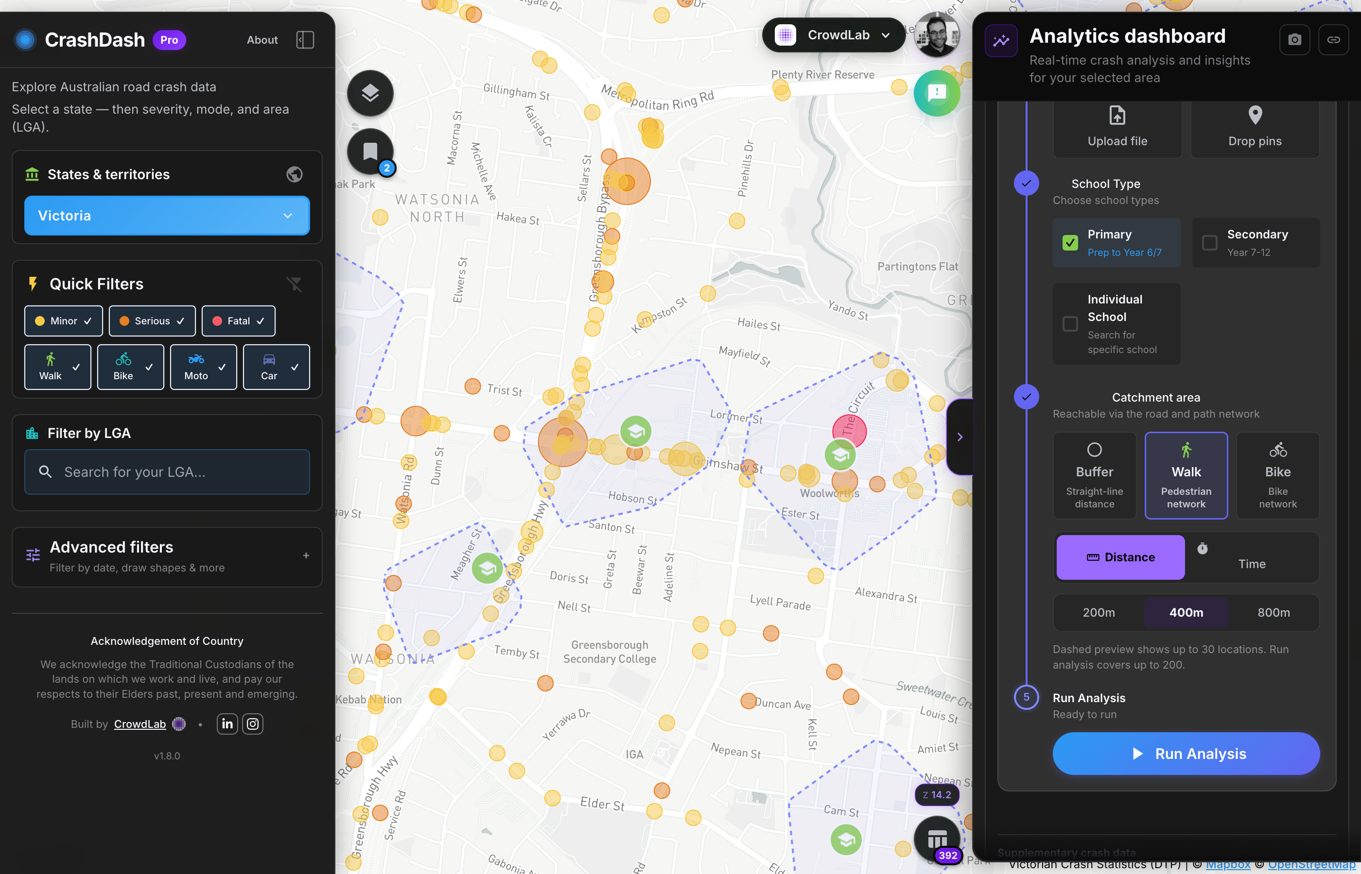
Proximity analysis
Count crashes near schools, hospitals, aged care or custom points. Adjust buffers and review severity, people involved and estimated social cost.
CrashDash for Councils
Built in collaboration with local councils. Used by council teams across Australia.
What councils use it for
“CrashDash allows us to quickly compare crash patterns during and outside the hours of an existing 40 km/h school-time speed limit. Being able to interrogate the data at that level helped us make a more informed, evidence-based assessment of a community request to extend the lower speed limit.”

When a resident flags a dangerous intersection, pull up crash history in seconds. Filter by mode, severity and date range. Share a direct link to the view.
Identify high-frequency sites and serious injury concentration. Use hotspot analysis to rank locations, then corridor analysis along candidate roads, and export to support grant submissions.
Document pre-intervention crash patterns at a site. Set a baseline before works go in, then track changes over time.
Use proximity, zone, corridor and hotspot analysis to compare locations and networks, see severity and social cost in one place, and rank where to invest next. Supports clearer briefings and evidence-based decisions across the team.
Combine hotspot, corridor, zone and crash cost views to support network safety planning and Safe System assessments. Map where to invest across your road network.
Share saved views with colleagues, drop maps into internal reports and brief managers or elected members from the same evidence. No more conflicting spreadsheets.
In the app
The same Pro tools on the homepage showcase: proximity around locations, polygons for areas, corridors along roads, and hotspot analysis for crash concentrations.
Count crashes near schools, hospitals, aged care or custom points. Adjust buffers and review severity, people involved and estimated social cost.
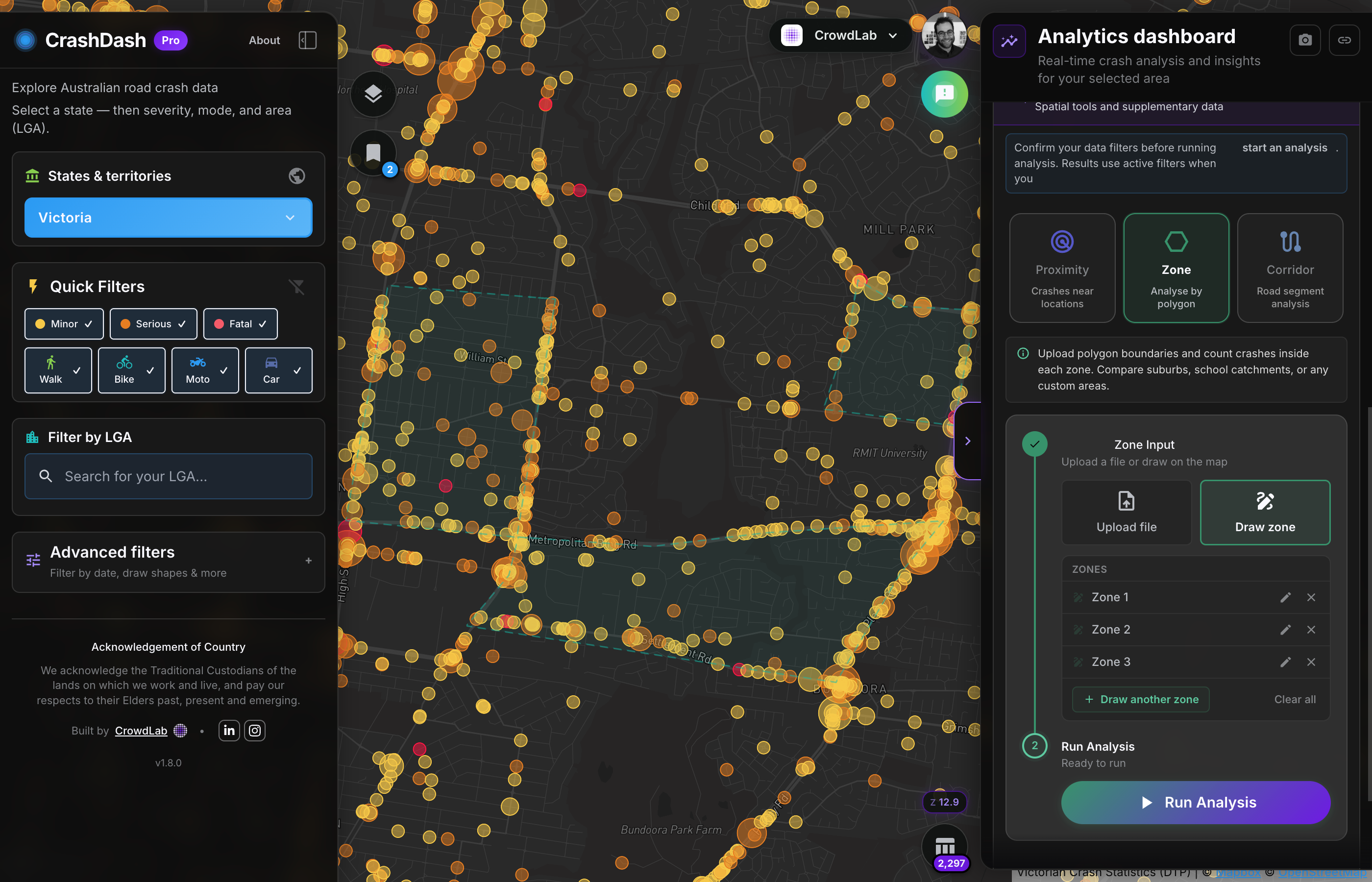
Upload or draw polygons to compare suburbs, project areas or catchments. See totals and rankings across zones.
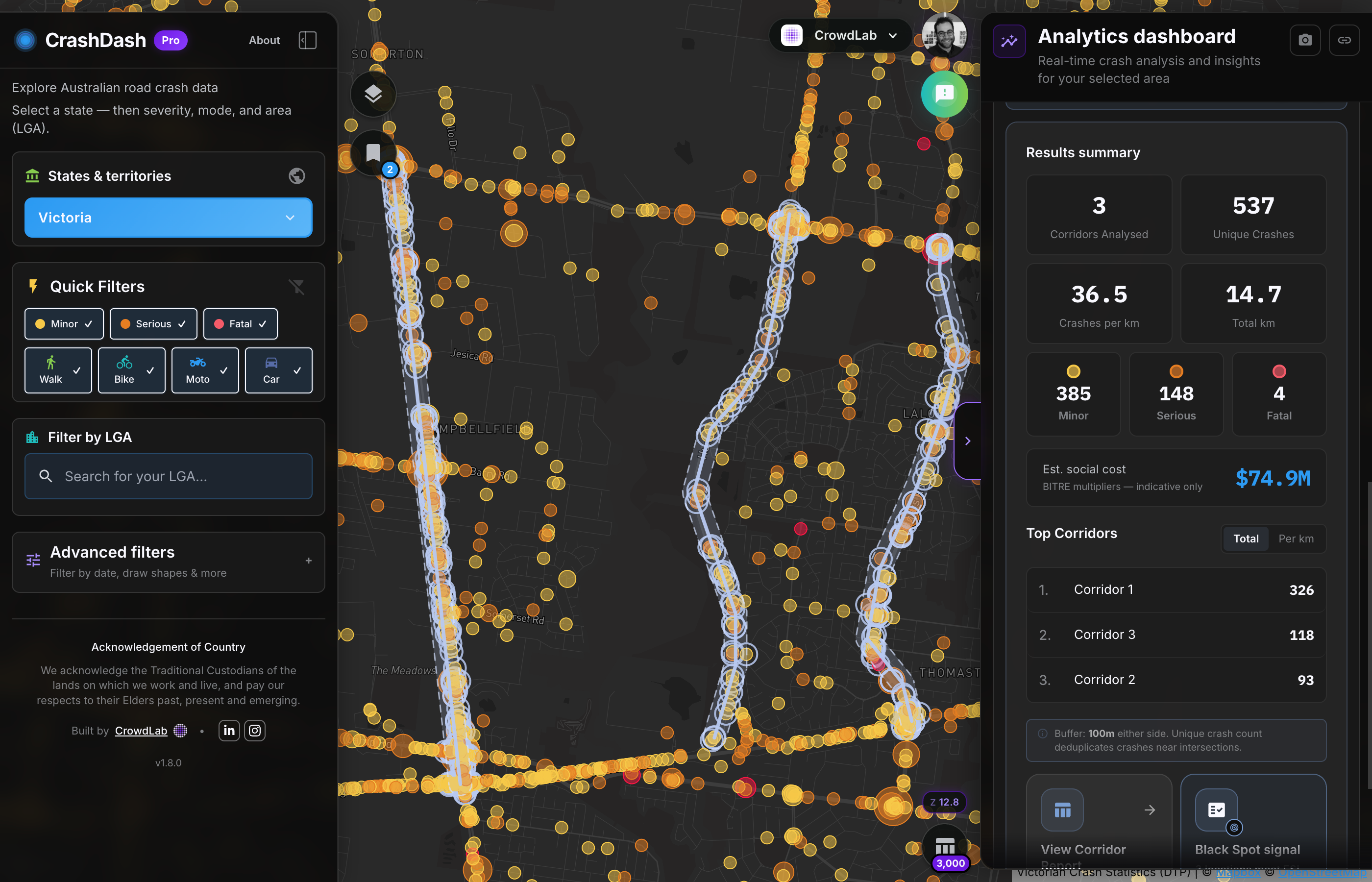
Define corridors along roads or paths with a set buffer. Built for Black Spot-style reviews and network safety planning.
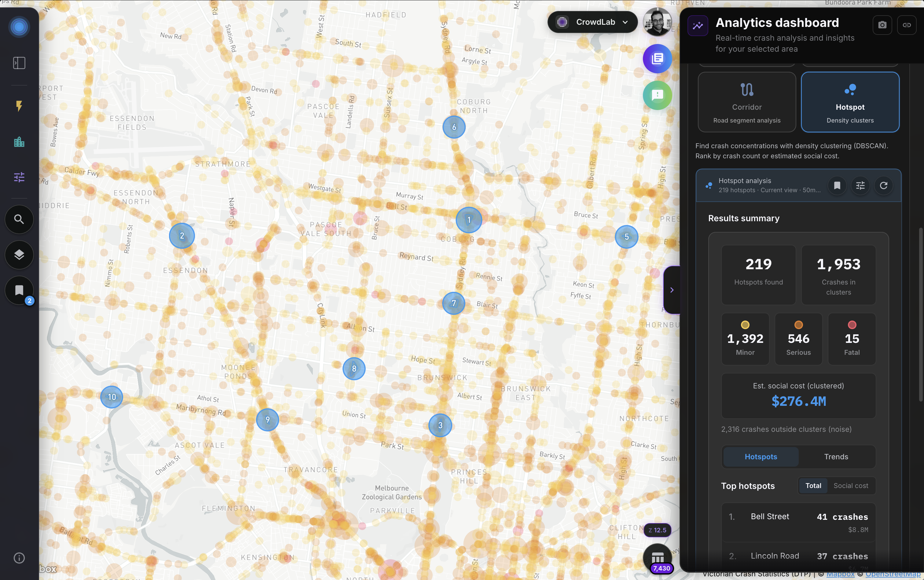
No upload required. Runs on the filtered crashes already on the map, so teams can go from an LGA view to a ranked site list without drawing corridors first.
Council Pro
One subscription for your whole team. Set up in minutes, not months.
Data
Organisation
Analysis and reporting
Administration
All features available to your whole team from day one. No per-seat pricing.
Five-year crash history, advanced filters, proximity, zone, corridor and hotspot analysis, and org accounts. Start a 30-day trial and we will explore your LGA's crash data with you.
Usually 15 minutes · or email us directly
Individual Pro for consultants and researchers is coming later this year.
CrashDash is also built for consultants, transport planners and researchers working independently.
Individual Pro
For consultants, planners and researchers working independently. Individual Pro for consultants and researchers is coming later this year. Create a free account to explore the map today.
Create a free accountCouncil Pro
Organisation-wide access with a 30-day trial. No per-seat pricing and no procurement process for most councils.