CrowdLab
Find your area
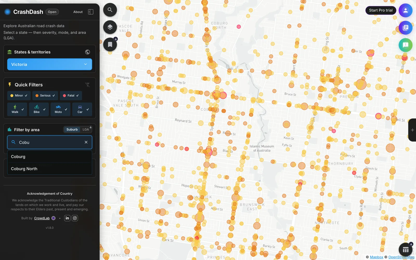
Pick a state or territory, then zoom to a suburb or LGA. Every state is mapped to the same fields, so a comparison across a border means the same thing on both sides.
Australian injury crash data · 7 states and territories mapped
Explore crash history in seconds. Compare your area and turn patterns into clear next steps.
No credit card required.
Council team?See Council Pro →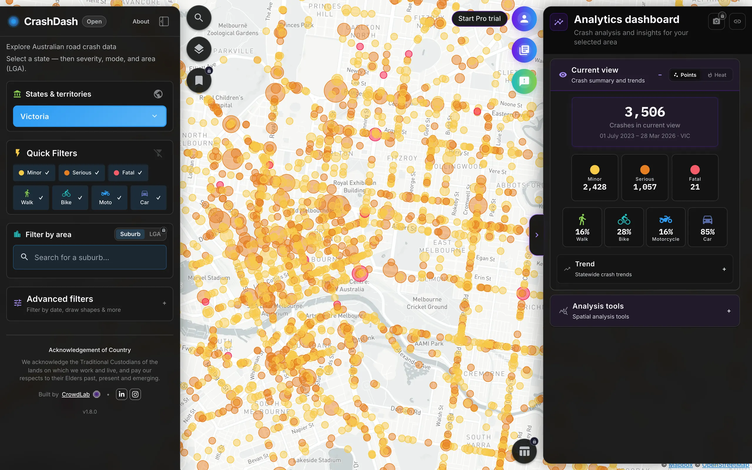
180,000+
injury crash records, cleaned and mapped
7
states and territories mapped in one national schema
5 years
of history on Pro, where states publish it




01How it works
Four steps on one map. The free map covers the first two. Individual Pro and Council Pro add the analysis tools and export.
Pick a state or territory, then zoom to a suburb or LGA. Every state is mapped to the same fields, so a comparison across a border means the same thing on both sides.
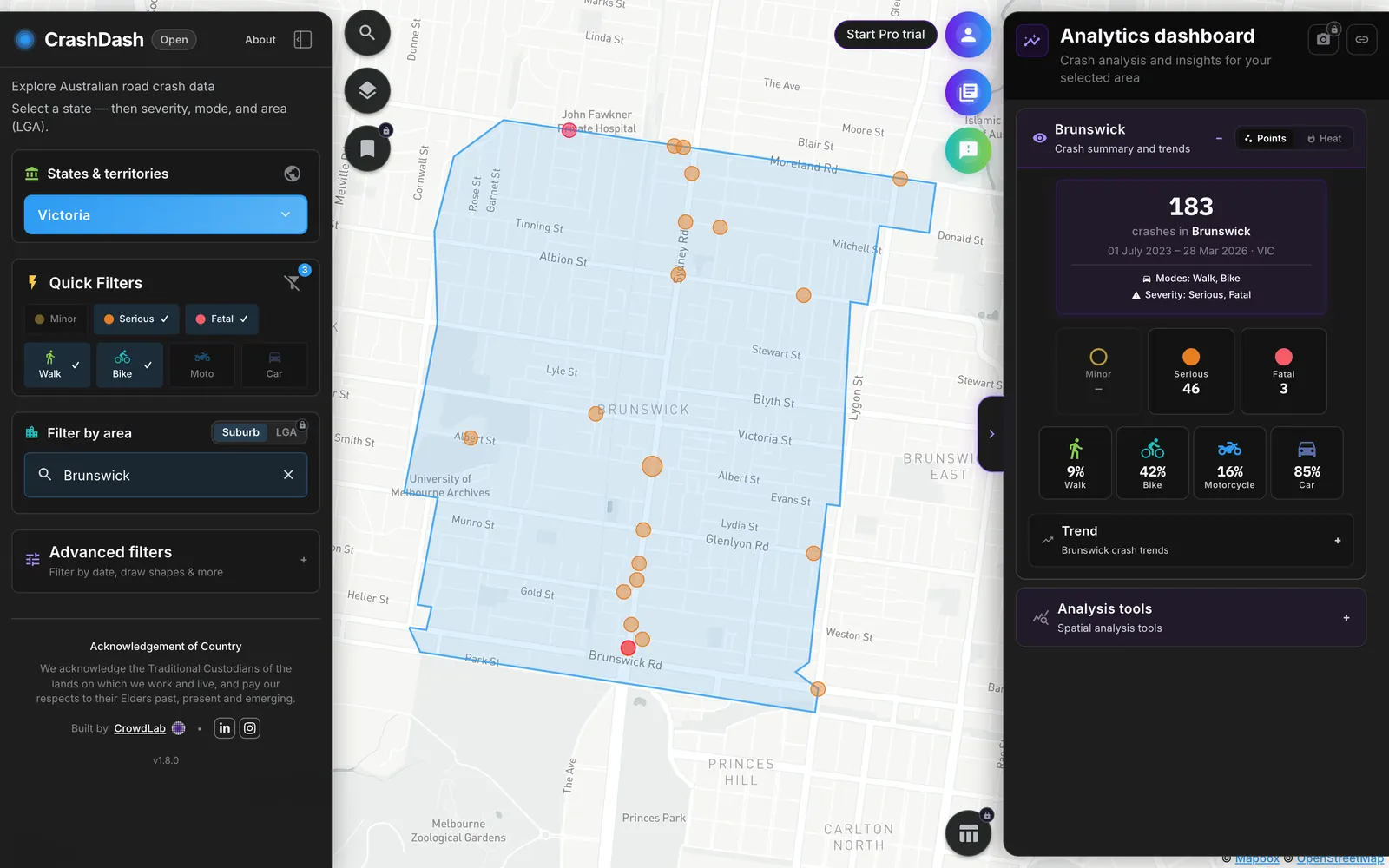
Severity, travel mode, date range, road authority and LGA. Narrow 180,000 records to the crashes your question is actually about.
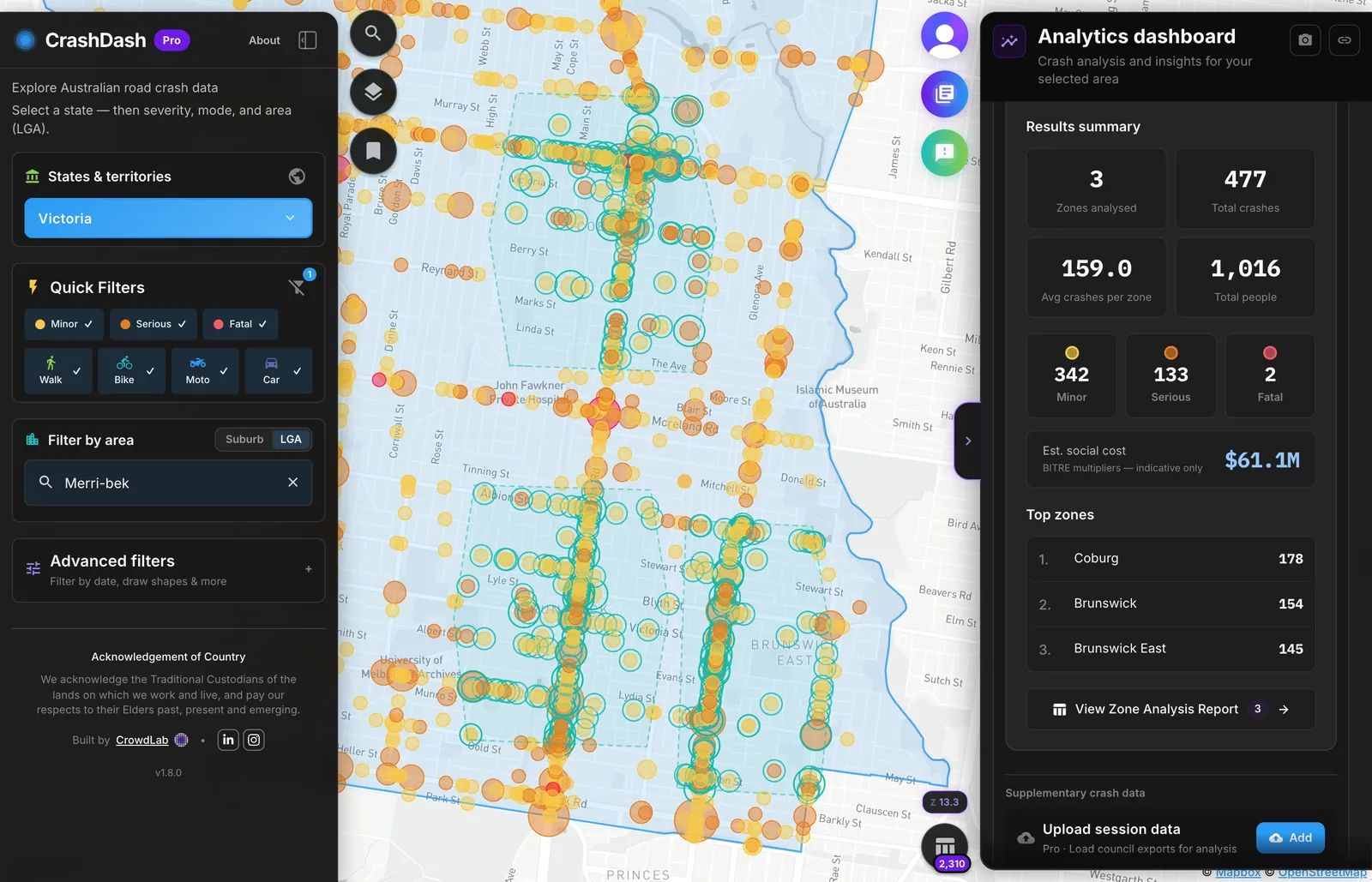
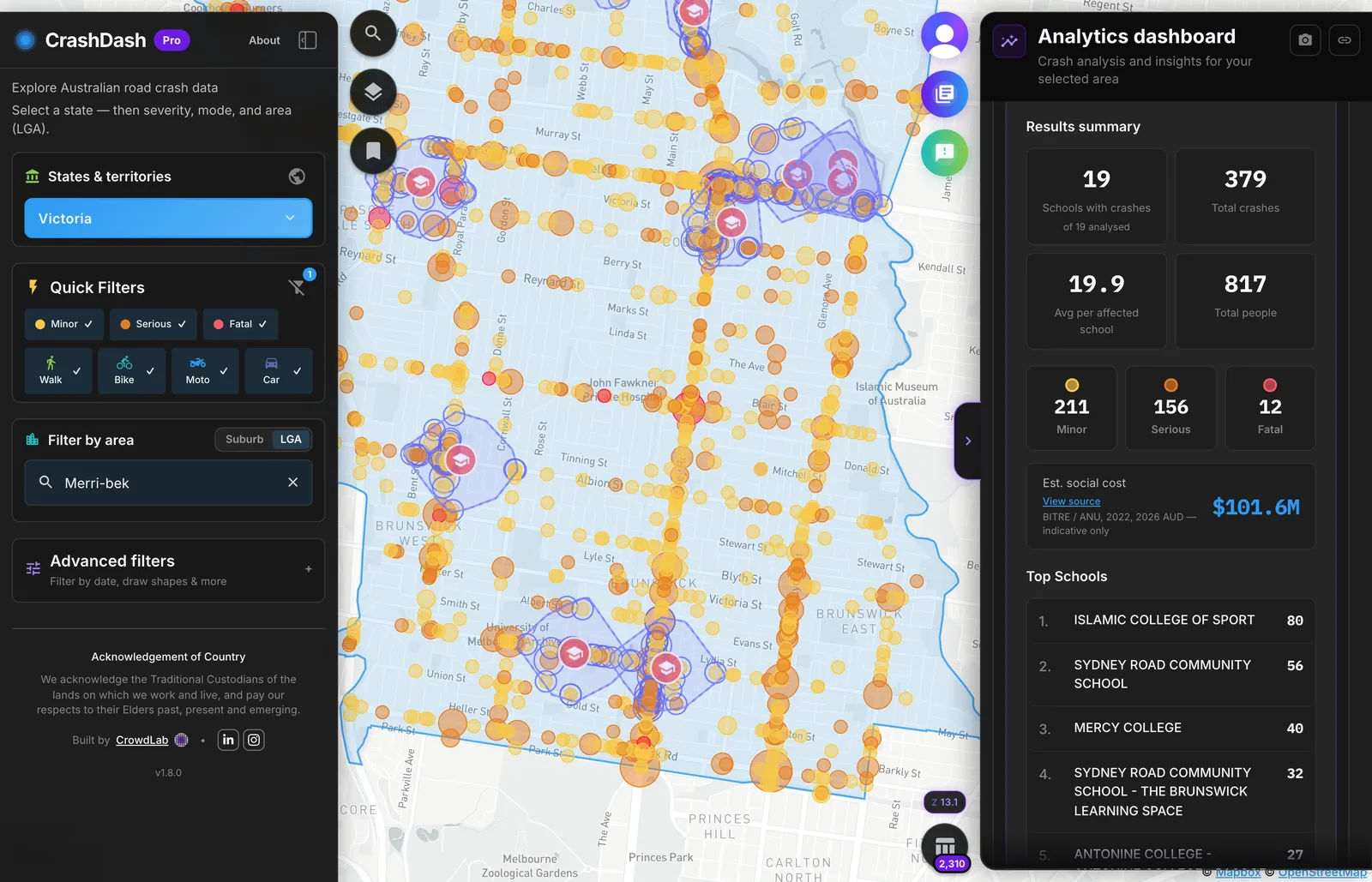
Count crashes near schools, hospitals, aged care or any custom location. Set buffer distances and review severity, modes and estimated social cost.
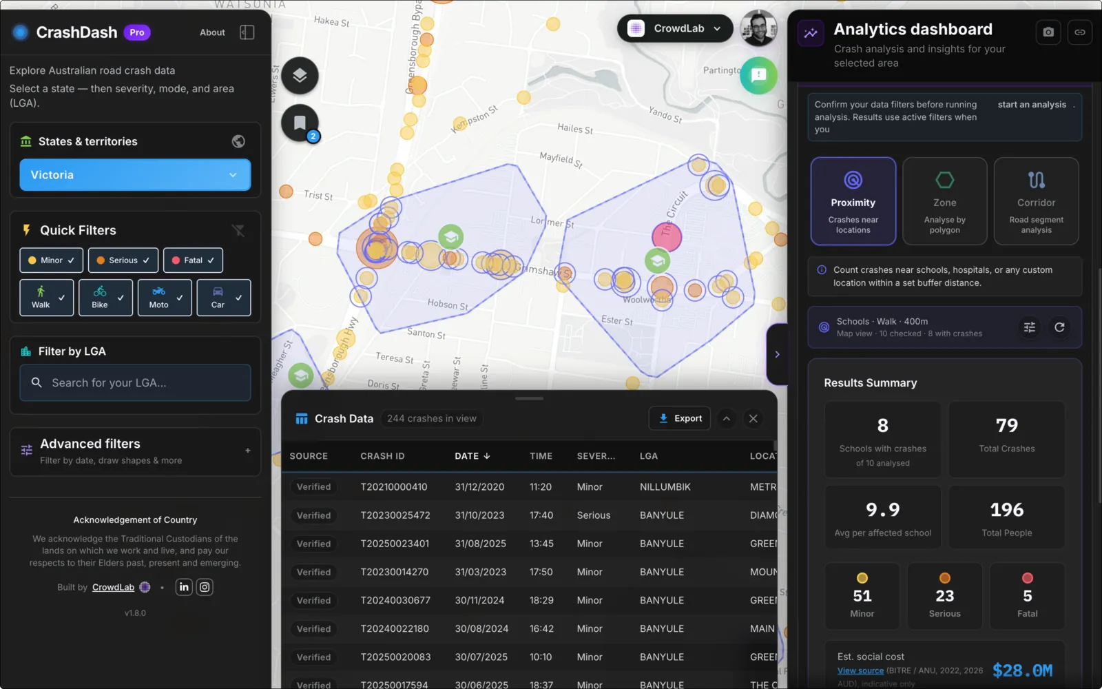
Open the crash table for your view and download CSV or GeoJSON for council reports, grant applications and workshop packs.
02Plans
Same national data, same analysis tools. Pick the plan that matches who is doing the work.
Council Pro
One licence for your whole team, scoped to your LGA. Start a 30-day trial and we will walk through your area's crashes with you.
Every Pro analysis tool and five years of data, plus
Individual Pro
The full analysis toolkit for one person, anywhere in Australia. Creating a free account starts a 14-day trial with no card.
Everything on the free map, plus
03What practitioners say
Much more accessible and user friendly than other crash stat maps.
I've already used it a few times. It's so handy for quick LGA checks.
Really useful for scoping crash patterns before deeper analysis.
A big milestone for making crash data easier to work with.
04Questions
Built and maintained by CrowdLab in Melbourne. Ask us anything about the data or your area.
Get in touchCrashDash is built and maintained by CrowdLab, a Melbourne-based studio led by transport planner Anthony Aisenberg. CrowdLab specialises in map-based tools for councils and road safety organisations and has delivered projects like BikeSpot, CrowdSpot and the Victorian Find My School tool.
CrashDash is currently self-funded and operated by CrowdLab, alongside project and consulting work with councils and government agencies. The national crash map is free to use and we plan to keep it that way. Maintenance and future development are supported through CrashDash Pro subscriptions and partnerships with organisations that use the tool in their work.
From official State Government sources across Australia and unified into a single national schema. We link to state documentation in the CrashDash app.
We monitor state government data sources and update when new data becomes available. Recent years are prioritised; legacy data is progressively backfilled.
It depends on the state or territory source. On the free map you can typically explore about three years of injury crash data. Individual Pro and Council Pro can access up to five years where the published data allows. The app shows the exact years available when you select a state.
National coverage across all 8 Australian states and territories. VIC, NSW, QLD, WA, SA, TAS, ACT, and NT are all included. Note: Spatial data for Northern Territory is not currently available, but crash data is accessible.
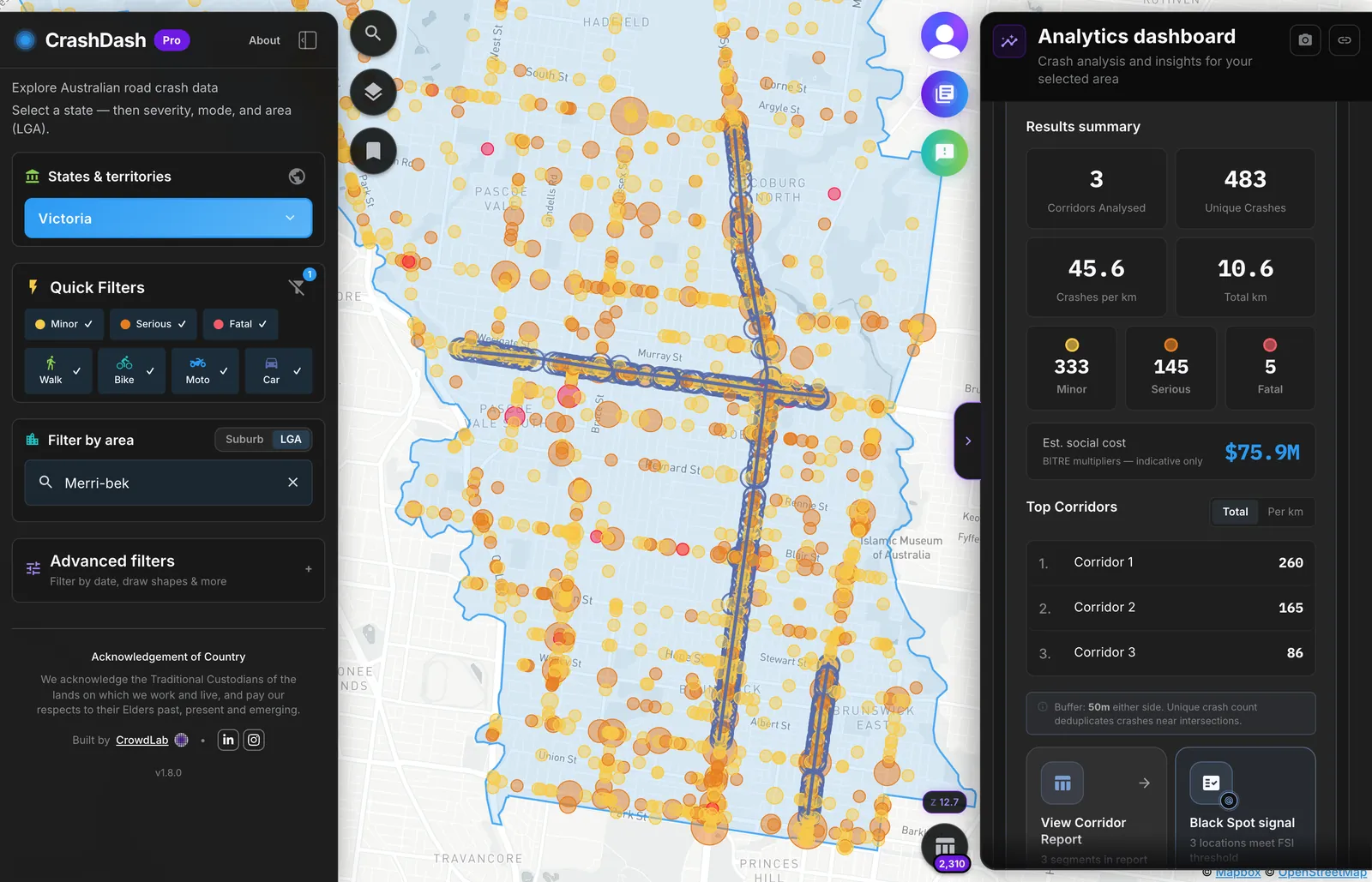
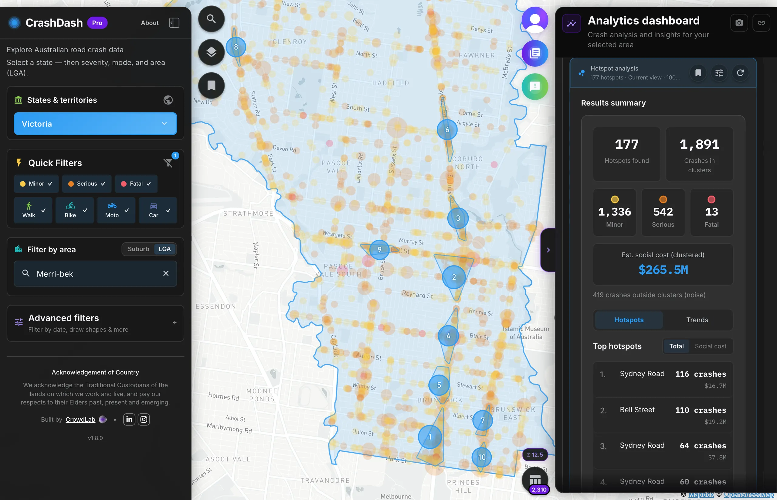
Yes, core features are free and will stay that way. Proximity, zone, corridor and hotspot analysis, table export, and advanced filters are included with Individual Pro. Organisation accounts are Council Pro. Individual Pro includes a 14-day trial with no card up front. Council teams can start a 30-day trial from the pricing or Councils page.
Yes. We actively co-design with councils. Contact us via the footer link or LinkedIn.
Open the map free. Create an account to save views and start a 14-day Individual Pro trial, no card needed.